Fall 2024
Upcoming Georeference-a-thons!
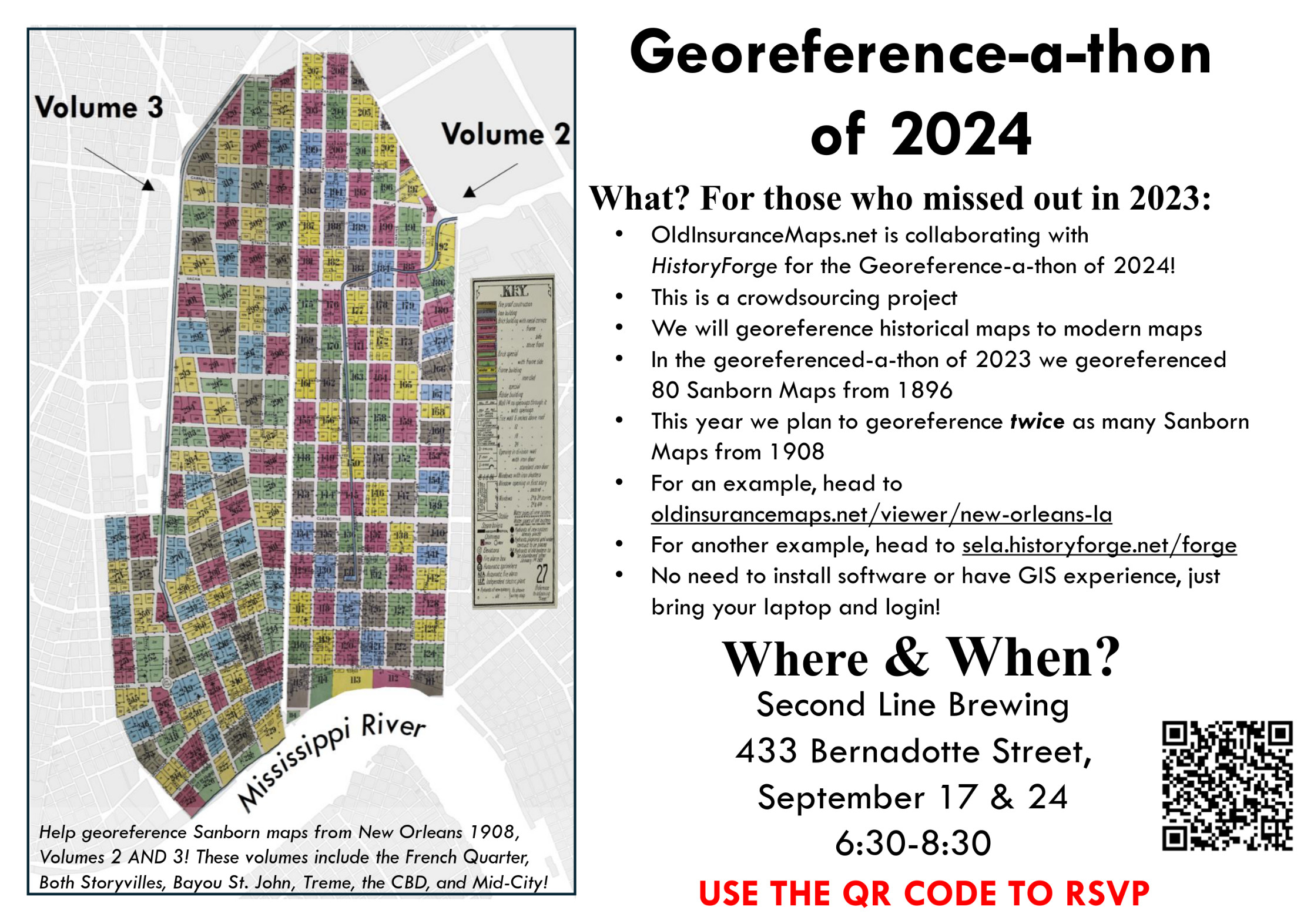
Here in New Orleans we have two public Georeference-a-thons right around the corner! On the next two Tuesdays we will be gathering at Second Line Brewing (as before) from 6:30 to 8:30pm to georeference more New Orleans Sanborn maps for HistoryForge. We did this last summer, and the resulting work has been integrated directly into the HistoryForge platform (as you can see in the link, click the map icon). Having the Sanborn map layers is very helpful for tracking down old US Census records, and makes exploring the city's history even more engaging. Hope to see you there!

A big thank you to Elizabeth from HistoryForge for making the flyer!
CC licensing update
Last winter, I wrote about my interest in applying a CC BY license to the work that people have completed on OldInsuranceMaps.net. Since then, I have done much more research on the topic by reaching out to people with experience in other crowdsourcing applications, as well as copyright experts within university libraries. Overall, I've found that CC0 will be a better fit for contributed content on the site, which would place individual contributions "as completely as possible in the public domain," to borrow Creative Commons language. CC0 is the most permissive Creative Commons license, and will allow the use of map content for research, personal, or commercial use. CC BY would require that attribution be given whenever content is used elsewhere, which sounds good in theory but would bring a level of enforcement and legal burden that I am not able to meet in practice.
More importantly, however, I've learned that the data created through the georeferencing process is unlikely to be considered copyrightable in the first place, because the cut-lines, ground control points, and masks are effectively recordation of facts ("this is the boundary of an inset", "this pixel coordinate corresponds to that lat/long"), and facts cannot be copyrighted. So the language I will be adopting soon will be along the lines of:
"To the extent that contributed content on OldInsuranceMaps.net can be considered copyrightable, a CC0 license is applied."
As before: If you are not comfortable with the work you have contributed being available through such a license, please get in touch with me ASAP. I will happily help you download/save your work elsewhere and remove it from the site.
Other Recent Work...
I have been working a lot in the past few weeks on a big re-modeling project within the database, which I hope to have fully implemented by next week. (But it has been a complex process so we'll just see how it goes...) You can read these pull request notes for more details on the changes. Some of the outward improvements that this will make possible are:
- Grouping mosaics from multiple volumes for better display in the viewer (currently this is kind of a mess for cities with many volumes, like the 10 new ones in New Orleans from the 1951 edition)
- A data model that more closely reflects the structure of the IIIF Georeference Extension, laying groundwork for its eventual adaption within the platform
- Complete (well, almost complete) removal of the dependency on LOC's map collection--a big step toward making the system more generic overall.
This is the topic I'll be presenting about at NACIS next month in Tacoma, so if you are attending the meeting please say hello! Even better, Riley Champine from the University of Richmond's Digital Scholarship Lab will be in the same session, talking about their work at the DSL, and in part their use of OldInsuranceMaps.net. I think these talks will be recorded, so I'll be sure to pass links to them on eventually.
All the best,
Adam