Hello all! Some announcements and recaps, plus a few updates on (subtle but important) improvements to the site.
Before going further though, I've scheduled another georeference-a-thon at Second Line Brewing for Tuesday June 27th, 6:30pm-8:30pm! You can RSVP here: https://forms.gle/wTMtoeHR3NwzXN4q8. Also, please fill that form out if 1) you can't make it on that day but would like to in the future, or 2) you don't live in New Orleans but would be interested in doing an event like this in your town. I'd love to discuss this idea with anyone interested.
State of the Map US (Open Street Map conference)
I'm recently returned from Richmond, Va., after a great weekend at State of the Map US, an annual regional meeting of the Open Street Map community. I presented with Jeff Meyer of OpenHistoricalMap on Friday, highlighting how you can use georeferenced Sanborn maps from OldInsuranceMaps.net directly in the OHM editor--an extremely easy way to trace old buildings and roads to add them into OHM. A perfect external use of the layers created through this project.
Presentation slides: https://tiny.cc/sotmus23-ac
We also did an OHM map-a-thon on Saturday morning, where folks digitized buildings by using the Richmond 1886 mosaic in OldInsuranceMaps that some of you had already georeferenced (esp. sbuckley730!), and some people started working on Richmond 1895 as well. Great to see some new people work with these old maps :).
Georeference-a-thon Recap & Redux
It seems like a while ago already, but the georeference-a-thon we did in May at Second Line Brewing went really well! About 10 people came, including some fortuitous overlap with a University of New Orleans urban planning department happy hour social. New faces are wonderful to see! We georeferenced about 1/3 of the New Orleans 1896 vol. 1 that we started, and, as you can see from the current state of that volume, people have continued to work on that content so it's over half done now. We still haven't setup direct integration of this layer into SELA HistoryForge, but we will get that done eventually.
So, as mentioned above, I've scheduled another event with Second Line at the end of this month (they told us multiple times how much they liked this old maps project). Hope to see you there, and maybe we'll finish this entire volume!
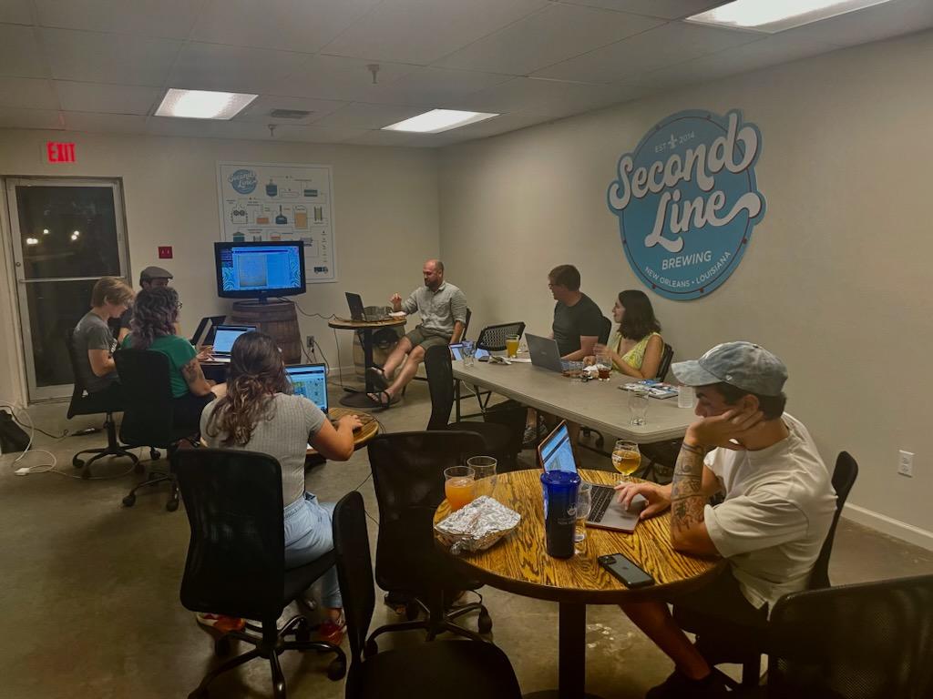
Thanks Elizabeth for taking this photo!
Site Improvements
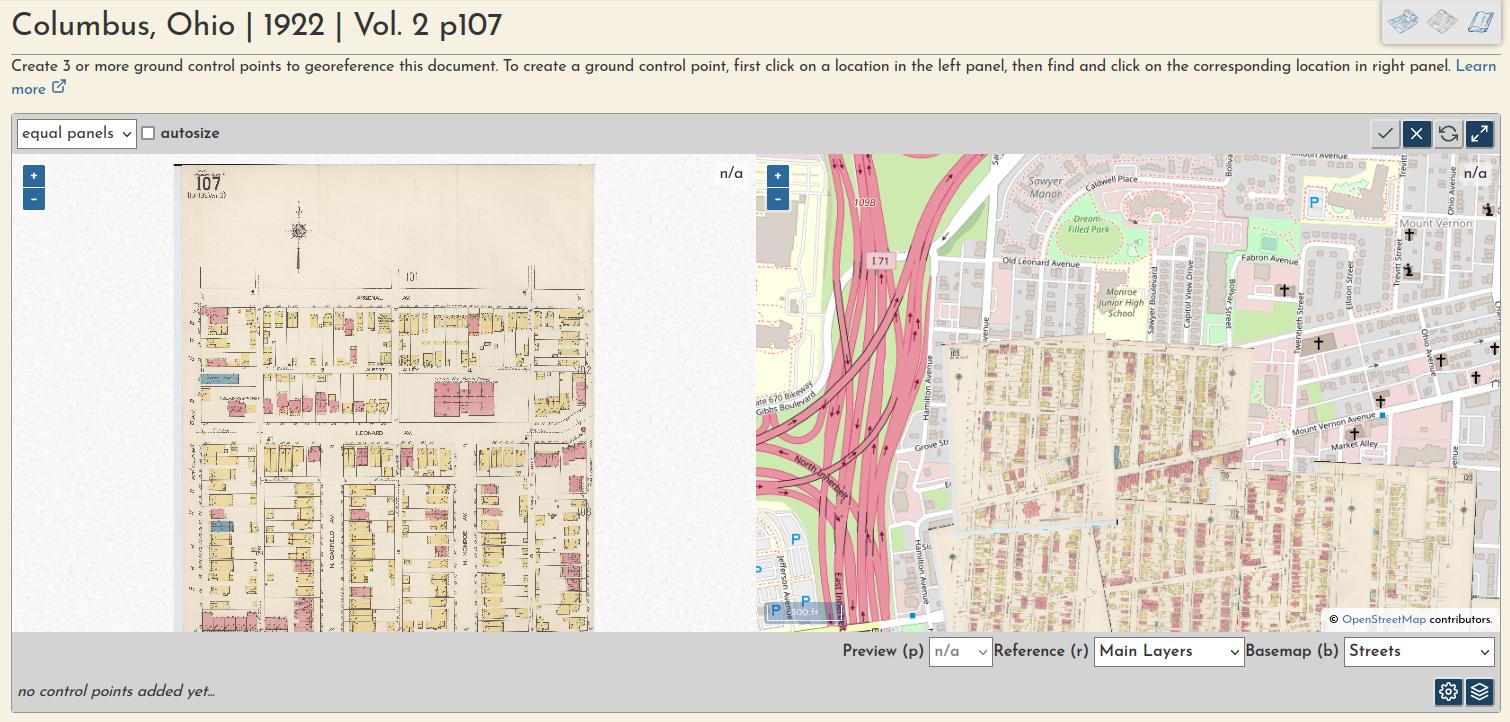
More reference layers during georeferencing
I've (re)introduced the Key Map as a reference layer during georeferencing, click the "layers" button in the bottom right corner to show this option or turn the layer off. Or "r" as a keyboard shortcut to toggle the reference layers.
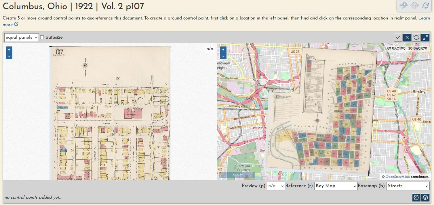
I've also added the option to show all already-georeferenced layers from the volume alongside the one that you are currently georeferencing. This allows you to make very small adjustments to make adjacent layers line up as closely as possible.
Use TiTiler for live georeferencing preview layer
I recently swapped out MapServer for TiTiler to generate the live preview during georeferencing. I've used MapServer for this one small functionality since the beginning of the project because it was easier to use with VRTs than GeoServer (and a fun excuse to learn a little about it), but now that TiTiler handles tile generation everywhere else (and natively serves VRTs), this was the natural next step. Happy to have it squared away.
Set documents as "non-maps"
I've finally addressed, at least in part, the very first ticket in the repo, a request for a way to mark particular documents as "not-georeferenceable." Now, once a document is prepared, you can mark it as a non-map, moving it into a separate category in the volume summary page. This is necessary for images like the title page and text index, and allows for a more accurate georeferencing completeness percentage to be calculated across the volume.
Improving management of other layer classifications
Also on the topic of content management, I've added a few more categories for layer classification within a volume. To date, we've just had Main Content and Key Map, but as we found a long time ago in Shreveport, some volumes include a "Map of Congested District," or, more recently in Columbus, a "General Index of Volumes." This content will overlap other content from the same volume, so it must be set apart so it can (eventually) be placed into separate layers in the Mosaic Preview map or main viewer... tiny steps in the ever-churning, slow move toward a more generic system.
----
That's all for now! If you recently signed up and are getting this newsletter for the first time, you can read my past sporadic missives in the archive.
Adam